The Smoke Bluffs municipal park, 27 hectares, is a people-oriented recreational amenity in a natural setting. It was established in 2003 due to strong lobbying by many outdoor activity groups. Local residents have been hiking and picnicking here since 1900.
The Climbers Access Society of B.C. has been using the smooth vertical faces of the cliffs since 1972. The Federation of Mountain Clubs of B.C. purchased three hectares in 1987 in order to keep developers away from the base of the bluffs at the Mamquam Blind Channel. Our municipality formed the Smoke Bluffs Advisory Group in 2005. These official efforts plus countless hours from unheralded volunteers has made the bluffs the most popular year-round climbing area in Canada.
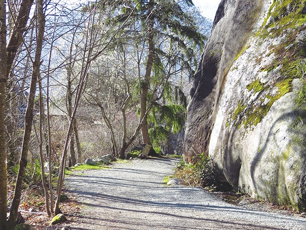
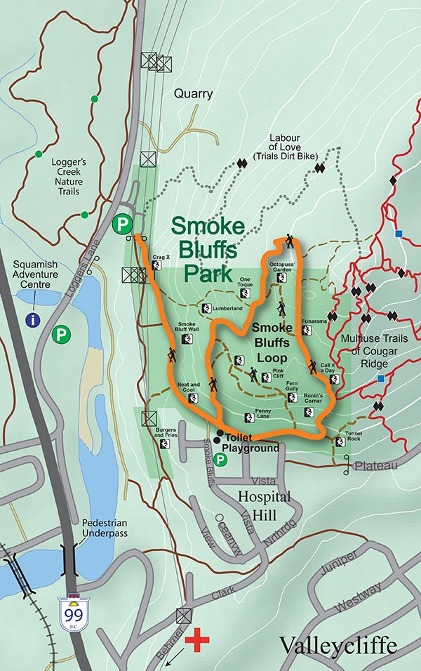
Climbers heading for the 400 short granite routes are not the main users of this park. The bulk of the park is devoted to hiking trails. Seven trails meander within the park boundaries, and at least eight more lead out of the park to the adjacent mountain bike zones around Mt. Crumpit.
These well maintained trails lead to a variety of fine viewpoints, the best of which are near the Mountain FM tower at the northeast corner. Residential growth downtown, east of Loggers Lane and in Valleycliffe will give impetus for increased use of this park.
Because of its ease of access, Smoke Bluffs Park is a natural hub of our municipal trails and recreation sites. Highly visible and easily accessed off Highway 99, this park is an enticement to the many splendours of outdoor recreation capital of Canada, where we’re hardwired for adventure, as the slogan goes.
In the early days of our town, the bluffs were called Bughouse Heights. It was likely that the more odd of the lumberjacks squatted up on top of the bluffs and away from the so-called “normal” folk living in Skunk Hollow, as Valleycliffe was then called. Until the more recent politically correct times, bughouse was a common slang term for a mental asylum.
With the onset of gentility and after a smoldering forest fire devastated the top of the bluffs, a better name came into use, although one climbing route in the centre of the park preserves the Bughouse connection.
Stewardship over this popular park is now the main role of the advisory group, which reports monthly to our municipal council and oversees the annual budget for maintaining seven trails, three toilets, two bike racks and all the signage. All the users of this park are encouraged to pack out litter and aid in minor trail maintenance. Climbers are keen to preserve their access and will often be seen scrubbing moss off the vertical routes and clearing brush at the launch/recovery spots. Good stewardship by all will definitely contribute to the future success of this park.
The closeness of the residential homes means that noise complaints are not uncommon. Climbers and all people enjoying the park need to be aware of the neighbourhood and avoid boisterous banter. Cooperation is the key that will allow everyone to enjoy this peaceful and scenic area.
Parking space is limited in the Hospital Hill area; one should not expect to be well received for filling up driveways. Better to use the large parking lot off the east side of Loggers Lane dedicated to Smoke Bluffs users.
The rock quarry at the western edge of the park is an active commercial site. The company occasionally sets off dynamite charges to break loose large columns of granite, so stay well clear of their fenced-off area. The overhead electrical transmission lines carry at least 230KV, which can kill; stay clear of any hanging wires and anything in contact with these wires.
Smoke Bluffs
These granite bluffs above Valleycliffe are busy with climbers and hikers. A 2.6 km loop around the bluffs was finally linked in 2010.
Origin of name: Originally known as Bughouse Heights, it became Smoke Bluffs in 1953 when a forest fire smoldered for a long time.
Trailhead: At climbers’ parking lot off the east side of Loggers lane, about 100 metres north of the Squamish Adventure Centre.
Use: Single track, multi-use.
Difficulty: Moderate. Blue.
Elevation: 9 metres up to 198 metres.
Etiquette: Travel quietly – noise pollution is aggravating.
Feedback: info@squamishtrails.ca.
Trails annual general meeting will be held Thursday, April 21, 7 p.m. at Arts Council Building.


