Brohm Lake is a popular recreation area and home to a provincial day use site operated by Squamish Nation Witness Society, Uts’am. The area around the lake is the Brohm Lake Interpretive Forest, operated by the BC Ministry of Forests, Lands and Natural Resources. Hot weather brings many to the cool and peaceful waters, so it’s best to arrive early in the day.
The interpretive forest was established in 1974 as an outdoor classroom for all citizens, giving us all the opportunity to learn about forests, forest management practices, the ecology of the area and local cultural history.
For thousands of years prior to 1858, Squamish people were part of a busy economic trade with interior nations. Signs of the trade routes are found nearby. From 1892 to 1974, this was an active logging area and pieces of wire and machinery are still visible around the old logging roads. The forest of fairly open second growth consists of western red cedar, Douglas fir, spruce, hemlock, lodgepole pine, alder and bigleaf maple. The 12 kilometres of trails are anything but smooth, but they are not over-challenging. The seven trails and two old forest service roads allow for a wide range of challenges
• The Lake Trail is a 3.6-kilometre loop around Brohm Lake. Parts of the eastern boulders and some of the northwest hills can be steep and difficult, and the wooden stairs and bridges can be slippery even when not wet. There are secluded nooks along the granite boulders above the lake that are ideal for sunbathing, swimming and diving. Be cautious when diving, as some youths have been injured on sunken logs and hidden rocks. Two new wooden bridges have been built over Bratt creek where it enters the north end of the lake. A few 300-year-old trees have survived on the western side of the lake.
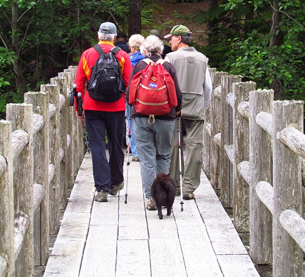
• The Bridge Trail is an easy, one-kilometre path from the main parking lot leading south to cross the long wooden bridge over the south end of the lake. This trail then joins those heading into the backcountry west of the lake.
• The High Trail is a 2.4-kilometre loop south and west on the ridges overlooking the Cheakamus River. There are some steep and overgrown sections over a rooty path at the start. It has a short section leading up to the old fire lookout, from which there are superb views, but the winds can be strong up there.
• The Cheakamus Loop is two-kilometre, rough trail with a few steep grades. This trail may be too steep for bikes. There are a few good viewpoints from the bare bluffs at the western side of this trail. The blackened stumps you will see are from the 1953 forest fire.
• The Creek Loop travels 1.5 kilometres north from the north end of the lake along Bratt Creek and old logging roads before turning right and heading 1.4 kilometres south under the powerlines to the main parking lot. These transmission lines from the Peace River area carry extremely high voltage; touching any part of the towers could prove fatal.
• The Alder Trail links the southern parking lot to the backcountry trails west of the lake. This 1.4-kilometre trail has an easy start up a smooth logging road until it enters the second growth alders after about 0.5 km.
• The Thompson Trail leads west up an old forest service road from the area of Bratt creek at the north end of the lake and over the ridge down to the Cheakamus River. Norm Halvorson helped to build this trail in the memory of Pres Thompson, who logged in this area in the 1960s. The higher trails seem remote and tranquil as they are not heavily used.
For an easy entry into the trails, head south from the main parking lot along the west side of Highway 99 and cross the long wooden bridge into the backcountry. Pets must be kept leashed. Biking is not permitted on all trails. The overnight camping ban is strictly enforced.
Brohm Lake Trails: facts
The seven trails give good access to the lake and the interpretive forest, where you can study nature, exercise your body and ease your mind in a beautiful setting. Swimming, fishing, paddling and picnicking are also popular.
Origin of name: William Brohm from Germany settled in the area in 1892 and had a small lumber operation nearby.
Trailhead: At both parking lots on the west side of Highway 99, 12 km north of downtown Squamish.
Use: single track, mostly hiking.
Difficulty: Moderate green to strenuous blue.
Elevation: 220 metres up to 348 metres.
Etiquette: Stay on marked trails. Take care not to disturb plants and wildlife.


