The Mamquam dike trail is a good example of government foresight wherein flood protection, improvements to fish habitat and gains to public health through better trails were all accomplished.
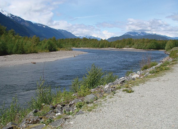
The trail is 3.6 kilometres in length and on a well-maintained gravel surface. The Mamquam River is 36 kilometres long, flowing south and west from the ice fields east of Mount Garibaldi.
For eons the flow was directly to Howe Sound along the western face of Handsaw Hill and Smoke Bluffs. This section became the Mamquam Blind Channel after the 1921 flood, which saw the heavy freshet cut a new path directly west to the Squamish River. This diversion was made permanent by the 1922 construction of the present dike along the north side of Centennial Way, which protects the growing number of residential homes along the east side of Loggers Lane and the very busy recreational facilities at Brennan Park. The municipal officials of the 1920s did facilitate urbanization through the construction to this dike.
This dyke did limit salmon access to the once-prolific spawning channels between Handsaw Hill and the Squamish Estuary. This decline became very noticeable in the 1980s, and the need to revitalize major spawning areas led to the provincial Salmon Enhancement Project (SEP).
The project implemented a plan to provide a flow of life-supporting water into the stagnant channels between Brennan Park and downtown. A culvert under the dike and a control gate were built near the power line in 2006, and oxygen-rich water started to flow. A very heavy rainstorm on March 5, 2007 eroded a small section of the south dike near the power line and a rapid placement of rip-rack stabilized the dike. This protected the newly built gate and channel carrying fresher water to the nature trail area. The Squamish River Watershed Society (SRWS) continues to monitor these urban wetlands and provides our community voice to the provincial and federal agencies.
The increasing number of visitors to our outdoors has put a heavy demand on the limited camping spaces available. To meet the growing needs of climbers, kayakers, paddlers, runners and bikers, a project is underway to create a rustic campsite at the eastern end of this trail. It will be located east of the eastern power line and above the riparian setback to the Mamquam River.
The Mamquam River Access Society (MRAS) has been granted approval to create about 50 campsites and fundraising is underway. The completion date is totally dependent on raising sufficient funds. Donations large and small can be made on the MRAS website and on PayPal. This project has the strong support of Squamish Paddling, Squamish Access, Squamish Windsports, Canoe Kayak BC, Vancouver Kayak and Squamish Trails.
Feedback: I received a few answers in response to a question I raised June 9 about why Jack Webster Bridge on the Sea to Sky Trail was so named.
Jason Decker gave me the most data, which I confirmed by checking the Jack Webster website. A massive freshet on the Cheakamus River Dec. 26, 1980 washed out the old logging bridge and almost topped Daisy Lake Dam. The about-20 residents in the area had to hike a bit to the railway and catch the “speeder” to get in and out. Various jurisdictions argued about the replacement bridge, and Herbert Scheer started writing to governments and newspapers. Slow progress got the famous radio host involved and his efforts brought a resolution that led to a new bridge. Someone painted his name on the new bridge, and this may rival his annual scholarship for “excellence in journalism in B.C.” as a lasting memorial.
Mamquam Dike Trail
A busy link along the dike on the south shore of Mamquam River leading to Brennan Park Recreation Centre.
Origin of name: Mamquam is the indigenous word for smelly water and refers to the smell of spawned out salmon, while a dike is a wall or embankment constructed to prevent flooding.
Trailhead: the south end of railway bridge over the Mamquam River near Government Road.
Use: double track, multi-use, non-motorized.
Difficulty: easy green.
Elevation: all at 12 metres.
Etiquette: Headphone users should keep one ear open.


