Individuals in the forestry industry say that erosion on the Stawamus River south of downtown is threatening Squamish Nation land and costing the industry money.
“The forestry industry is feeling the brunt of the issue, but we want to draw attention to the erosion problem that has increased during recent years,” said Squamish and District Forestry Association director Eric Andersen.
The Stawamus River runs into Howe Sound near the Mamquam Forest Service Road. The mouth of the river runs into the Mamquam Blind Channel and divides Stawamus 24 from Squamish Nation-owned industrial logging lands just south.
While erosion on the banks of the river is not threatening houses on the reserve, it is destabilizing a bank of the land leased to Squamish Mills, said Andersen.
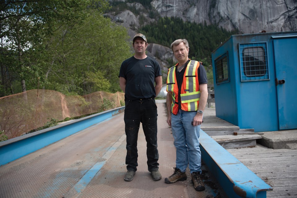
On May 10 the company was forced to move their large truck scale beside the river because it was no longer safe to use for weighing.
“For now we have to move it, but the river is only going to get worse and worse. If it had been fixed last year, we might have been able to keep it here and save $50,000,” said, superintendent Phil Mazzotti.
Mazzotti said the truck scale is a critical piece of infrastructure for the local industry and is used by a number of companies. The road leading into the park is also close to the eroding bank.
“This site has really fallen through the cracks,” said Andersen.
“One of the reasons is because it’s so complicated. We have fisheries here, Transport Canada, Crown land, Squamish Nation, District of Squamish and industry players.”
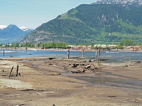
In addition to the issues for the forest industry, Andersen said silt and gravel from the river is increasingly making the blind channel shallower at low tide, presenting issues for boaters.
He said the bank ideally would first be shored up, followed by dredging and a long-term maintenance system. The solution would require co-operation from multiple government bodies.
Officials from the Ministry of Forests, Lands, Natural Resource Operations and Rural Development said that staff has been in communication with the forestry association about Crown land permits for any remediation work that should be applied for as soon as possible.
Andersen said the Ministry told the association that permits could take up to a year.
“That’s not very good when you have an emergency situation,” said Andersen.
Department of Fisheries spokesperson Janine Malikian said now that the scale has been moved, the proponent can submit a “request for review” to obtain a Fisheries Act Authorization for repair work on the eroding bank.
District of Squamish manager Gary Buxton, in an emailed statement, said that the District has already made an application for dike protection grants in highest priority areas of the community.
He said the Integrated Flood Hazard Management Plan includes correcting issues along with “correcting deficiencies in the Squamish River/Mamquam/Stawamus River dike and completing the sea dike protecting downtown/Dentville.”
“These projects will protect hundreds, or in some cases, thousands of properties and billions of dollars of land, infrastructure, and buildings. Typically, in a case where a flood protection project would only protect one property, it would be built and maintained by the landowner,” said Buxton.
Andersen said he is hopeful that funding can be leveraged through the Hazard Management Plan.
“We do realize that the District has other priorities in diking elsewhere — safety first — but we see this as being important to their relationship with Squamish Nation,” said Andersen.
“We hope that this project can be on the list in applying for funding with the province to do mitigation work.”


