Though we recognize it for its beauty — or traffic woes — most of us who drive the Sea to Sky highway weekly, if not daily, rarely think about the landscape to the right and left of the road and what formed it.
That is not the case for Melanie Kelman, a volcanologist with Natural Resources Canada. Since she was a little girl inspecting pebbles with her hobby rock collector dad, geology has fascinated Kelman.
The Sea to Sky Corridor has a wealth of interesting geological features that Kelman has discussed in presentations and that she helped to outline in a federal government pamphlet, “Sea to Sky GeoTour: geology and landscapes along Highway 99 from Vancouver to Whistler.”
The Chief caught up to Kelman for a chat about our landscape and her career.
What follows is an edited version of that conversation.

Q: In researching your career, I noted at one point you were looking for gold in ancient volcanic rock?
A: That is one of the jobs I had in south-central B.C. before I worked for Natural Resources. A lot of ore is hosted in ancient volcanic rock. I actually spent a lot of my time looking at drill core in an old barn! Rocks are really interesting.
Q: What continues to interest you about geology?
A: I think partly it is because it is all around you. I like the outdoors. If I hadn't studied geology, I would likely have done some aspect of biology, because both are things you could study pretty much anywhere on earth.
Q: It is funny looking at the presentations you give about the Sea to Sky Corridor because those of us who live here drive by not really thinking about what we are seeing.
A: We sort of think of geology as unchanging and except for sudden things like significant volcanic eruptions, landslides and flash floods, a lot of the processes are very slow to our eyes. You can look at pictures from Squamish 100 years ago and they pretty much look the same in terms of the geology. That is the same all around the world, so you get this picture of the landscape that changes slowly compared to human life that changes really fast.
Q: Volcano emergency planning is a big part of your current job, correct?
A: Yes, that is right. With the federal government, my job is mainly focussed on public safety. In Canada, our volcanoes don't erupt very often, but some of them we don't know very much about and some are in very isolated areas. It is good to get a picture of what is going on and a picture of what the hazards are — especially with volcanoes. People think of a lot of natural disasters and hazards as just happening and there is nothing you can do about them. That isn't really true with volcanoes, especially volcanoes that haven't erupted in decades or centuries. They tend to give a lot of warning signs before they erupt. For example, there will be swarms of hundreds or thousands of tiny earthquakes that you would detect with instruments. There may be deformations of the surface that are very subtle, like millimetres or centimetres, which you would detect with different methods — GPS or satellite methods. Also, looking at volcanic gasses that are bubbling out of hot springs or being emitted from a vent. All of these things can tell you what is going on with a volcano and give you some idea of what is going to happen. From the point of view of public safety, we can actually say a great deal before a volcano erupts about what might happen. Around the world, the accuracy of volcano forecasting has gotten better.
Q: Are there any you are currently watching that are acting in those ways you describe?
A: There's no unrest in Canada right now. In Alaska, there are one or two that are on alert. [Go to www.avo.alaska.edu to see current volcano alerts.]
Q: Many of us have been watching the eruptions in Hawaii, what do you think when you see what is going on there?
A: It is pretty impressive. It has been going on at a pretty high level for a number of weeks. I was following the situation as it developed. When I was there in 2013, we could see lava flowing into the sea and that has been going on for decades. But of course, this particular eruption has been pretty exciting. It is relatively predictable, and unlike in movies, lava usually doesn't move faster than you can walk.
For the people who have lived there for decades, it is tough though. When people moved there they might not have realized how hazardous the area was. There's not much more that you can do than move out of the way.
Q: In terms of the Sea to Sky Corridor, many topics in your presentation were interesting and new to me. Can you talk a bit about glacial erosion that you can see while driving along the highway?
A: Howe Sound is a fiord, so it is a glacial valley that has been flooded by the sea. During past ice ages, and in the most recent one, that would have been filled by ice, and the ice sheet would have been about two kilometres thick. Rock would fall onto the ice and get picked up by it and underneath it and on the sides and so the rock erodes. Unlike a river valley that has a V-shaped cross-section, a glacial valley has a U-shaped cross section and so it has often steep, often near vertical sides. Think of the sides of the Stawamus Chief. There are some nice erosive features in Squamish. Down at the base of the Chief, there are some highway stops where you can see some nice sculpted whalebacks — they are called whalebacks because the rock is smooth and curved and look like whales. You can also see scratches in some places, which are glacial striations [ridges] which indicate rock embedded in the ice was being dragged along the surface and it tells you the direction the ice was moving.
Q: What can you tell us about Shannon Falls?
A: There's a hanging valley there. During glaciation there will be a big glacier in the main valley and there may be tributary glaciers coming high up into it on side valleys. When all the ice melts away, the little side valley that joins to the main valley is stranded up high and so in this case, it is called a hanging valley. The water comes through this notch and cascades down this near vertical surface and forms this spectacular waterfall.
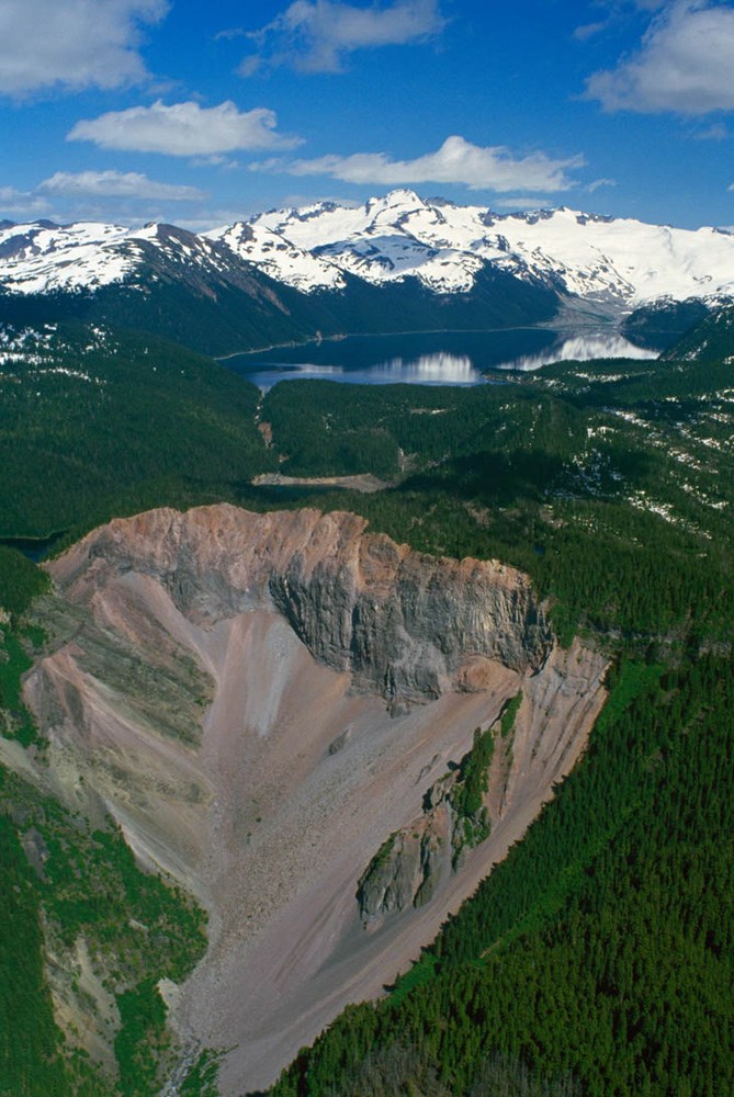
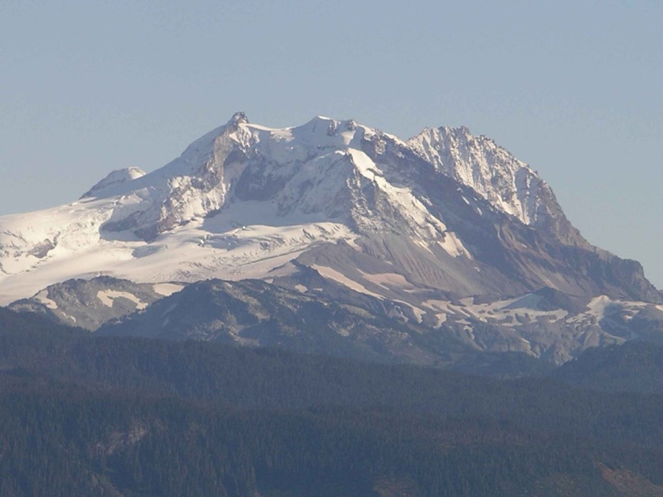
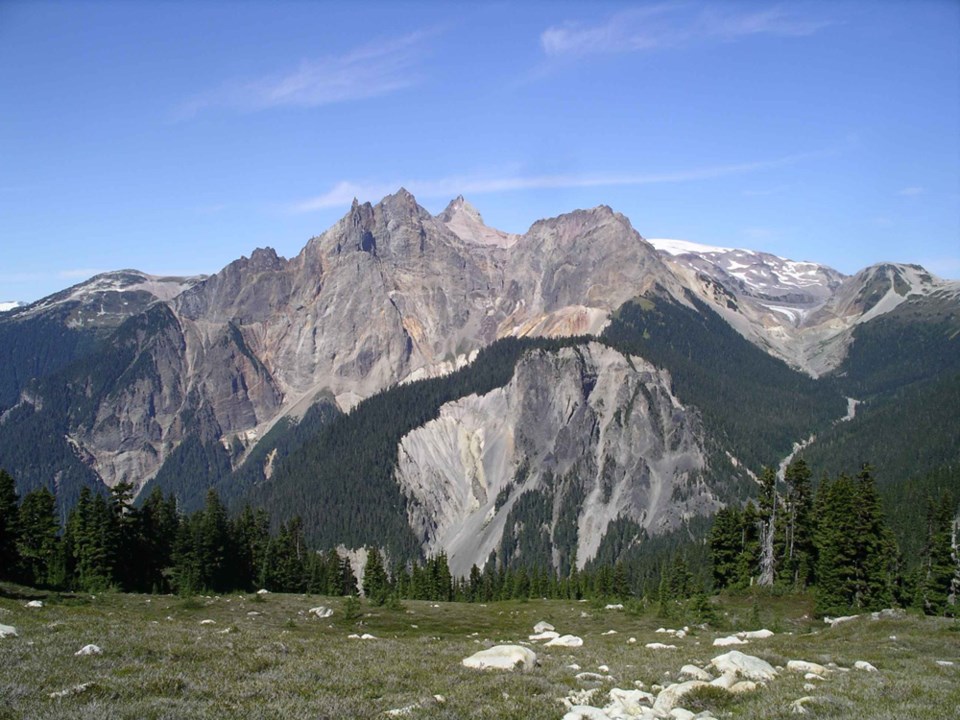
Q: There is a lot of concern about Mount Garibaldi. There was a mid-19th-century landslide there, can you speak to that?
A: Mount Garibaldi is a stratovolcano built up of many eruptions. Clinker Peak and Mount Price are a few of the stratovolcanos in Garibaldi Provincial Park.
During the end of the last ice age, the ice was gradually melting away, and there was some stagnant ice left on the floor of the valley. Higher elevations would have been bare of ice, and so a lava flow erupted from Clinker Peak and flowed downhill and encountered this ice that was left in the valley and was essentially dammed against it and of course some of the ice would have melted, but it also froze the lava, so it formed a lava dam. Therefore, you get this essentially very steep-fronted lava flow, and it is very prone to land sliding. There's evidence of significant landslides from there. There was the one in the mid-1800s that was reported by both First Nations and by the few Europeans that were in the area.
This feature that is prone to land sliding is called the Barrier. [The Barrier is a lava dam retaining the Garibaldi Lake system]. It is day-use only in that area because of the landslide hazard. We aren't going to stop people from passing through, but by not allowing people to camp right underneath it, you are minimizing the number of people who are there at any one time.
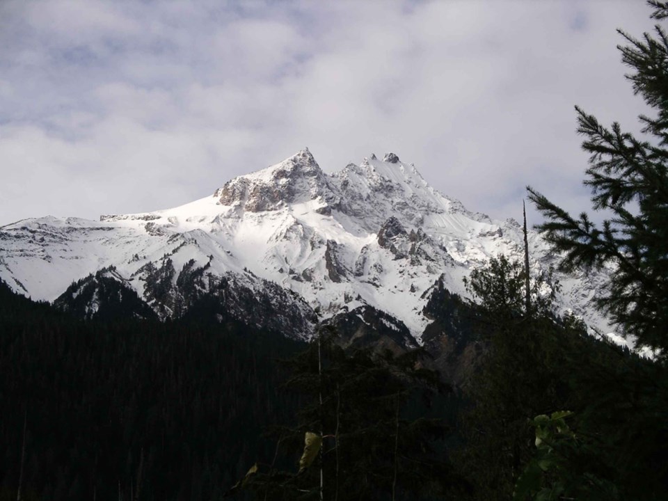
Q: With Pemberton's Mount. Meagre, what is the deal with that dormant volcano?
A: It is the only volcano in Canada, as far as we know, that has had an explosive eruption in the last 10,000 years. It had a big eruption about 2, 350 years ago and scattered ash across B.C. and into Alberta — and likely further. We certainly know it has the potential for big eruptions, though there are no signs of current unrest.
Q: Did the 2010 Mount Meager landslide have anything to do with it being a volcano?
A: The landslides at Meager are linked to it being a volcano because it is made of all these layers of volcanic rock that are often not very solid. They are hydro-thermally altered so they are clay minerals, which are very weak and slippery and tend to slide along and are very fractured. It is also very steep and subject to freezing and thawing action each year. All of these things mean that it is not very stable so there's a lot of rock that could potentially slide. There have been lots and lots of historic slides there and lots of evidence of prehistoric ones too.
Fast facts about the Sea to Sky Highway
*At Porteau Cove Provincial Park, hidden below the surface of Howe Sound is a giant submarine ridge of boulders, gravel, and sand that stretches from Porteau across the fiord to the far shore. This ridge rises 250 metres from the sea floor to within 30 metres of the surface. The ridge marks the forefront of a glacier that was present 10,000 years ago. Today, the glacier is long gone, but the ridge of debris remains.
*We know Britannia was home to a copper mine, but how did the copper come to be? According to geologists, the mine ores formed a hundred million years ago when a hot spring deposited metals on the volcanic seafloor. Heated seawater, circulating deep through volcanic rocks, leached metals from the rocks. The metals were carried to the seabed where they accumulated as a large deposit. Seafloor mud and lava from nearby volcanoes covered the metals, protecting the deposit from dissolving back into the seawater. The ores were later faulted and folded during several periods of uplift and mountain building.
*Mount Garibaldi is only half a volcano. It erupted and built a large cone during the waning stages of the last Ice Age about 13,000 years ago. At that time the Squamish Valley was filled by a massive glacier.
~From Sea to Sky GeoTour by Natural Resources Canada.
***Please note, this story has been updated since it was first posted to provide the correct caption for the Mount Cayley photo.


