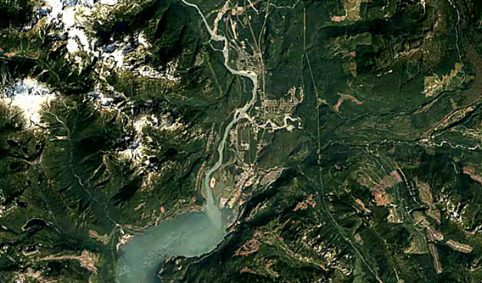
A program launched by Google this week shows change in Squamish over the last three decades, including new roads, homes, commercial buildings and logging activity.
(See below for the video.)
Earth Engine is a searchable database that uses five million images from 1984 to 2016 of all over the world.
The images of Squamish show the district growing as new roads make it easier to get around, downtown becomes more dense and neighbourhoods are built further out.
Most of the images come from Landsat, a joint USGS-NASA earth observation program that has observed the earth since the 1970s.
Do you notice anything interesting? Let us know in the comments.


