In November of 2017 the Ministry of Transportation released an archival video from 1966, as part of their BC Road Trip Time Machine photolog series.
Mounting a 16mm camera on top of a vehicle, the ministry takes viewers on a drive from Horseshoe Bay, through downtown Vancouver, up Main street then onto Kingsway to Burnaby.
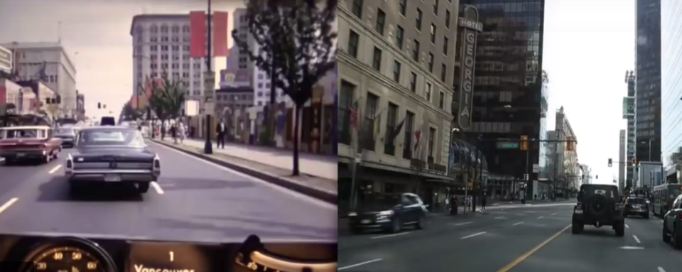
This week somebody decided to do the same drive, and put the videos side by side to show what it’s like to do it 52 years later. Starting at Taylor Way instead of Horseshow Bay, six7? does most of the original trip.
There are obvious changes like the types of vehicles seen whizzing by and the fact that BC Place doesn’t exist in the original video. Keen viewers might pick up landmarks like the clock at Kingsway and Mt Pleasant, and others, appearing on the right (new) side.
According to the Ministry, the roads traveled in this video “were classified as provincial Highways 1 and 99 until the early 1970s. In fact, Kingsway was also a component of the Trans-Canada Highway until construction was completed on the current alignment of the TCH across the Fraser River on the Port Mann Bridge in 1964.”
Enjoy this “highway” drive, which has been condensed into a quick 4 minutes, below.


