PENTICTON, B.C. — Residents and property owners in part of British Columbia's southern Interior are being asked to prepare for potential flooding due a forecast of thunder showers mixed with rain and sunshine.
The Regional District of Okanagan-Similkameen says the flood risk has increased considerably due to cooler temperatures and delayed snowmelt, and rain could raise the flow of rivers, creeks and tributaries and affect homes in low-lying areas or floodplains.
The district is asking people to be proactive by removing personal items that could be damaged by high groundwater or flooding.
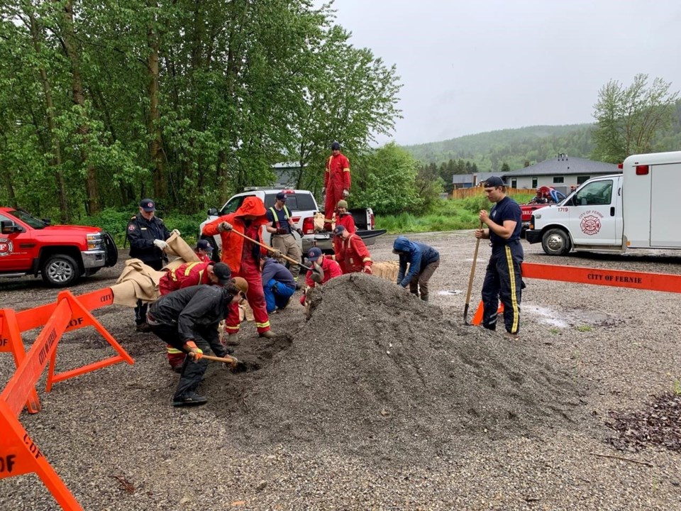
It's also offering sand and sandbags at 13 locations and has posted a video on its website on how to fill, move and lift sandbags, which should weigh less than 20 kilograms for building walls to protect property.
Local states of emergency are in effect in two southern B.C. communities and evacuation alerts have been posted elsewhere as run-off from recent heavy rain reaches rivers.
However, forecasters say the immediate risk of a major flood is subsiding and some flood watches have been downgraded.
The City of Kelowna declared its emergency late Tuesday as Mission Creek topped its banks, flooding numerous roads, yards and basements.
In Sparwood, a local state of emergency remains in place, with two mobile home parks and several other properties on evacuation alert due to surging levels of the Elk River.
A flood warning issued for the river through Sparwood and Fernie has been downgraded to a high streamflow advisory because the River Forecast Centre says flows remain high due to the recent storm, but the river isn't expected to reach the flood stage.
The centre has also downgraded other flood watches in southeastern B.C., while it's maintaining the watches for the north and South Thompson regions, the Shuswap area and for sections of the Quesnel River east of Williams Lake.
Despite the general easing of conditions, Emergency Info BC says local flooding in the southern part of the province has prompted evacuation alerts in rural Grand Forks, ongoing alerts west of Tulameen and in Harrison Mills west of Hope, as well as a localized flooding alert issued by the North Okanagan village of Lumby.
A flood warning posted more than a week ago remains in effect for the Liard River and its tributaries between Fort Nelson and Watson Lake in northeastern B.C., while waterways across the extreme northwest corner of the province are still covered by a high streamflow advisory.
This report by The Canadian Press was first published June 15, 2022.
The Canadian Press


