It was unquestionably a wet weekend in Squamish, but how wet was it?
The Squamish airport saw 180 millimetres fall from Thursday, Oct. 14 to Sunday, Oct. 17, according to Squamish meteorologist Jason Ross.
An Atmospheric River brought 180 mm of rainfall to Downtown #Squamish. Beginning the evening of Thursday, October 14th through Sunday, October 17th 2021. #BCStorm #BCwx @ECCCWeatherBC @miawgordon @MMadryga @50ShadesofVan pic.twitter.com/CS8hxYtOAD
— Jason Ross (@Squamishweather) October 18, 2021
On Friday, a flood watch was issued for Howe Sound by the River Forecast Centre (RFC).
This provincial government body monitors, analyzes and models streamflow conditions across B.C.
A flood watch is issued when river levels are going up and will approach or may exceed capacity, and flooding of areas around the rivers may also occur.
But it wasn’t a ferocious deluge for this time of year.
In fact, it was pretty standard for Squamish, Ross said.
“Certainly not out of normal for this time of year,” Ross said, of the rainfall tally.
“This was a setup right of the subtropics — an atmospheric river event pointed right at the South Coast,” he said.
Ross himself was out in the elements volunteering for a very wet Squamish 50 race most of Sunday, he said.
The terrain in the Howe Sound contributes to the amount of rain we get due to a thing called orographic lift.
Ross explained that with orographic precipitation, rain, snow, or other precipitation is produced when moist air is lifted as it moves over a mountain range.
“As the air rises and cools, orographic clouds form and serve as the source of the precipitation, most of which falls upwind of the mountain ridge. Storms approaching the coast are lifted rapidly along the windward slopes, resulting in widespread precipitation. Much of the heaviest precipitation occurs along the southwestern slopes of Howe Sound,” he said.
Ross explained that orographic precipitation, rain, snow, or other precipitation is produced when moist air is lifted as it moves over a mountain range. As the air rises and cools, orographic clouds form and serve as the source of the precipitation, most of which falls upwind of the mountain ridge. Storms approaching the coast are lifted rapidly along the windward slopes, resulting in widespread precipitation. Much of the heaviest precipitation occurs along the southwestern slopes of Howe Sound, he said.
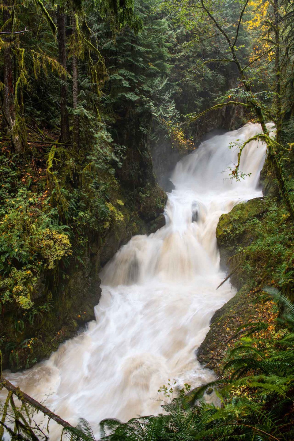
<<BC Hydro>>As is often the case, BC Hydro had to adapt its operations in the Sea to Sky due to the rain.
A spokesperson said the Crown corporation started to increase spill from Daisy Lake Reservoir starting around noon on Oct. 17.
“We plan to reduce spill levels on the Cheakamus River starting early Monday morning (Oct. 18) and will have monitoring/salvage crews out on the river as levels decrease. We’ll continue to slowly ramp down over Tuesday and Wednesday when crews will also be onsite. Crews will include 20 personnel with additional crew members on standby to ensure we can salvage as many fish as possible,” the spokesperson said.
Earlier this month, thousands of fish, including spawning pink salmon, were stranded and killed when too much water was taken out of the river after a storm, leading to outrage from the Squamish Nation and some local conservationists.
“As per our discussions with First Nations, stakeholders, and agencies last week, we’ve incorporated the following learnings to the Cheakamus Adaptive Stranding Protocol (CASP) to better protect fish: We’ll be significantly increasing the number of monitoring and salvage crews on the river; The majority of the ramp downs will occur during the day to allow for improved access and response to stranding areas as they emerge; and we’ll have the ability to pause ramp downs based on observations in the field, and we will also have contingent crews available to support efforts as needed,” reads the emailed statement from B.C. Hydro.
<<Comparing puddles>>Ross said if more rain had fallen to the north of us there could have been more of an impact seen in Squamish, but our neighbours to the north didn’t get the rain we did.
Whistler, from its Nesters station, saw 76 mm while Pemberton Airport saw 47 mm.
Ross said had Whistler received the 75 to 150 millimetres that were predicted for the resort — a prediction that led to a special weather statement from Environment Canada on Oct. 14 — there would have been more issues with flooding in Squamish.
“What goes on in the Pemberton area, the upper reaches of the Squamish Valley, Elaho, that is getting into the backside of the Pemberton Meadows and the upper Lillooet River. What goes on up in the mountains there, effects down here. It worked out [in] our favour. Had we seen the higher amounts, we probably would have seen some flooding in the Sea to Sky.”
And Squamish certainly saw nothing like Port Mellon, which endured a whopping 342 mm over the weekend.


