It’s a great time of the year to hike, bike or horse ride around Ring Creek.
The creek flows southwest off the east side of Round Mountain and is a full-flowing stream fed year round by glaciers near Mount Garibaldi.
The Merrill and Ring Logging Company operated from Valleycliffe to Brohm Lake in the years 1926 to 1948. Logging by rail was their "modus operandi" because the very large old-growth trees were too slow to get out by other means.
Many of their rail beds now serve as forest service roads and trails. Some FSR's are still active and everyone must be aware that fully loaded logging trucks need all the roadway space.
Ring Creek lava flow came south out of Opal Cone on Mount Garibaldi about 10,000 years ago. The flow followed the then existing contours of land and curved southwest to end just beyond Darwins Bridge.
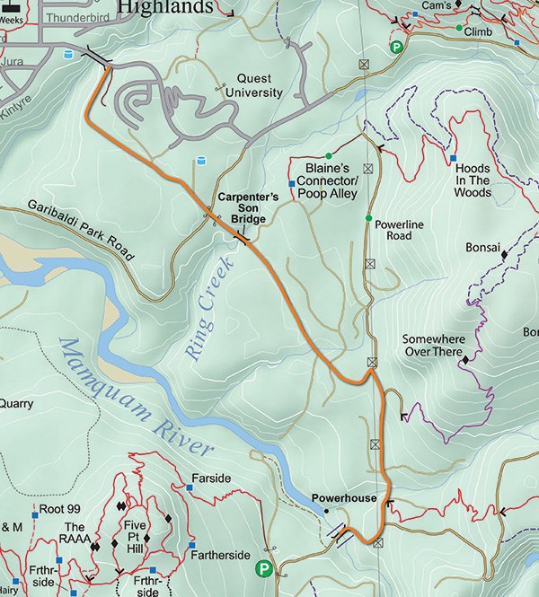
Trail usage in the lava flow area was once contentious but is now very collaborative. The maintenance road to service Skookum Power Project should make for easier rides in the lava flow.
There are agreements in effect between SDBA, SORCA and government departments for the dual use of some trails and specific use of others. Everyone is encouraged to join the greater community insistence of mutual respect. Obey the signage because use of crown land does depend on smooth relations.
Ring creek aquifer is a major source of our municipal drinking water. The well field consists of seven deep wells located in the lave flow northeast of the powerhouse on the Mamquam river. A groundwater protection zone covers 400 hectares between the powerhouse and Darwins Bridge. All who travel in this zone must lessen any contamination of the groundwater by carrying out all residues, especially oil/gas spills and pet/human excrement.
Ring Creek hamlet is a loose collection of 20 homes and cabins located about 15 kilometres up the Garibaldi Park FSR. These properties have been converted to freehold over the past decades. They are off-grid and as such are not supplied with water, electricity, sewage removal or road repairs. This FSR is only graded occasionally and is often in poor condition.
Ring Creek falls trail #532 links the Highlands to Valleycliffe and is a popular hiking trail. It passes through the University Heights subdivision, which Holborn Holdings are in the process of expanding. The developers have agreed to maintain trail connectivity through their property and may be able to shield the trail from the new houses.
Ring Creek
This area south of Garibaldi Provincial Park abounds with challenging bike trails and fine hiking paths.
Origin of name: Clarke L. Ring (1862-1933) was a partner in Merrill and Ring Logging Company that logged this area in 1930s.
Trailhead: Various entry points along Garibaldi Park Forest Service Road.
Use: Single-track multi use.
Difficulty: Blue.
Elevation: 202 to 550 metres.
Etiquette: Bikers yield to hikers and horses. Hikers yield to horses.
Feedback: [email protected]


