Former Squamish mayor Corinne Lonsdale remembers taking a passenger train to school when the Mamquam Bridge washed out in October of 1955.
“Anybody north of the Mamquam River… we had to take the train to school,” Lonsdale recalled.
The students took the train for at least six weeks, according to Lonsdale.
Floods were common in Brackendale throughout her childhood. She recalls more than once floodwaters reaching the balcony of a friend’s apartment building.
“There was no diking on the Squamish River north of the downtown area at all and none on the Mamquam, so it used to flood fairly regularly,” she said.
Mitigating against serious flood is the goal of the district’s Integrated Flood Hazard Management Plan, currently in its third phase.
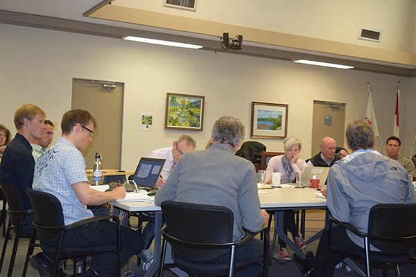
The River Flood Risk Mitigation Options report, which is part of the overarching flood mitigation plan, was before council on Tuesday at the committee of the whole.
Bringing the dikes up to provincial standards and the Squamish River dike up to a level where it could withstand a one-in-500-year flood event will cost the district almost $82 million over several decades, according to the report.
The focus of the discussion Tuesday afternoon was the conditions that need to be set for district staff and council when they assess rezoning applications within the “conditional densification through rezoning” area of the Squamish and Mamquam River floodplain.
Council previously agreed to mitigate flood risk by limiting density in high-flood areas while allowing development in such areas zoned residential neighbourhoods in the Official Community Plan, if rezoning applications met 10 conditions.
At Tuesday’s meeting, council did not endorse two of the conditions, the first being to restrict developers to building up the property with fill to take it out of the floodplain.
“For me to make a decision, I need to really have a clear graph, some sort of pros and cons list of filling big chunks of the site versus an alternative way of minimizing risk,” said Mayor Patricia Heintzman.
Council also couldn’t support the condition of limiting density to two-unit dwellings for some properties in the most risk-prone areas. Again, council wanted more information and options.
Developer Don McCargar, who owns property zoned greenway corridors on Depot Road in Upper Squamish, said he opposes the path the district is taking because it would mean his land is excluded for possible residential housing.
“My land underneath their proposal will be exempt from rezoning and exempt from an OCP amendment. I am dead in the water,” said McCargar, who has offered to help pay for part of the dike if council permits rezoning of his property for a housing development.
For about the past six months, while council and staff have dealt with flood mitigation options, any in-stream applications to develop on the affected lands have been on hold, and new applications have not been processed. This has had an impact on approximately three landowners with applications already with the district, including McCargar, according to the district.
Kirsten Gagne, who owns property on Grant Road in Brackendale, told council the deferral has impacted her and likely others. She went to Municipal Hall in January, she said, and was told it would be better to wait until the deferral was lifted before putting in a development application for her property.
“It is not just one landowner or two landowners affected, it is potentially quite a few,” she said, adding she found the proposed conditions onerous. “From my point of view, I have a 2.2 acre parcel, it is relatively small, but I was hoping to provide more affordable lots that are flat and level so that I could not only have a house there for my family, but for other families who are looking for that in Squamish. With these measures, I probably won’t be able to do it.”
District staff agreed to come back to council with the revised river flood report in a month, at which time council will consider lifting the deferral, according to staff.


