A new geotechnical analysis shows that the Squamish Municipal Airport can be divided into several segments, each with its own factor of risk.
On Nov. 2, council received the report.
The next step would be to create a strategy that would govern the use of the facility.
Given the need to get community feedback, this could take a couple more years.
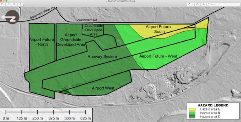
The analysis divides the airport into three areas, each with varying levels of risk, as the airport is in the path of a debris flow area.
Area A, the southeastern tip of the facility, is the area with the most risk. This area should be reserved for low intensity, non-habitable uses, such as storage space and hangars.
Area B, the southwestern zone of the facility, has some risk. A viable long-term plan for this area might allow for some habitable spaces, like offices.
However, the majority of new development should take place in Area C. In this zone, which is northern half of the airport. That's because this is the area with the least amount of risk.


