Since last Friday, we have seen a variety of alerts about Sea to Sky Corridor rivers. How do experts decide when to use what advisory? And why are we seeing warnings now in Squamish?
David Campbell, a hydrologist with the Ministry of Water, Land and Resource Stewardship’s River Forecast Centre, explained to The Squamish Chief that, generally speaking, there are three different levels for advisories: high streamflow advisories, flood watches and flood warnings, which Squamish is currently seeing on the Squamish and Cheakamus rivers.
The centre tends to put out high streamflow advisories when experts see the potential for the rivers to have high flow periods.
"That's based on weather forecasting, looking at our river models and interpreting that information and having a bit of an outlook in terms of what is expected in the coming days," Campbell said.
For a flood watch, there may be the potential for increased risk of flooding and uncertainty around whether the waterway might be reaching a flood stage.
Flood warnings are issued when there is evidence that there may be imminent breaching of the river’s banks or flooding.
Campbell said it can be challenging understanding where that threshold is on a particular river, especially if it isn’t gauged or the centre doesn’t have modelling.
“You might not know exactly when the water starts going over the bank," he said, noting that the centre uses other information, such as historical flows, to inform their decision on advisories.
What does that number mean?
When the River Forecast Centre releases an advisory, or in Squamish's case this week, a flood warning, it comes with flow volume information.
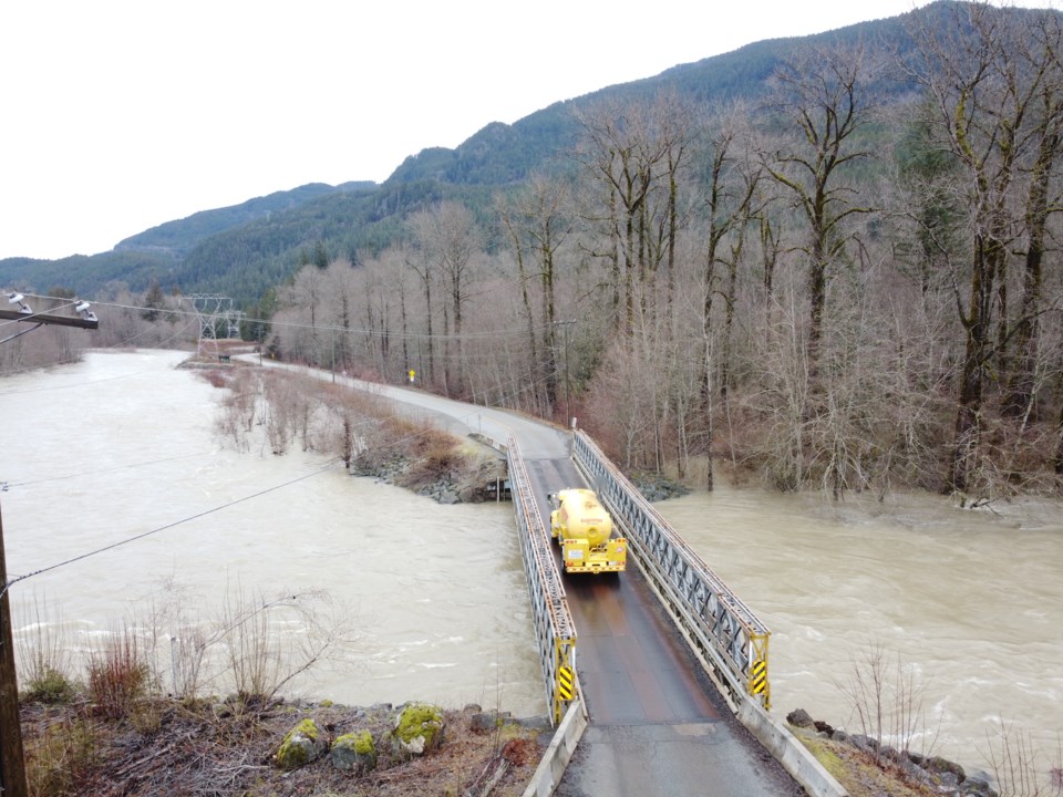
On Jan. 31, for example, the flood warning states: "Squamish River and tributaries (including Cheakamus River) – current flows at the Water Survey of Canada Gauge near Brackendale has dropped to 780 m3/s and it has begun rising."
The number is a measure of the volume of water that's coming down every second; 780 m3/s means the water in the river is flowing at 780 metres cubed per second at that particular gauge.
Why are we seeing such high flows now in some Squamish rivers?
Campbell said the Squamish River and its tributaries are currently so high for a few reasons.
"We've had that storm-on-storm cumulative impact of rainfall that has been coming since Friday," he said.
"It's been really, really warm. On top of that, we've had additional snow melts, which have been really quite significant volumes of snowmelts."
And then, the heaviest rains have been in the Squamish River headwaters, he said, referring to the Pemberton region, where the Squamish River originates.
Once in a five-year event?
So far, the current high level of the rivers is said to be a once in five year flow level. But this doesn't mean it will for sure not happen again for five years, Campbell said.
"It really is looking back at the historic record. And then you kind of go through an average 100 years of record—roughly once every five years we see this kind of flow."
And while we are at the once in five year flow now, there is more rain to come tonight, he cautioned. Thus, that figure might change.
What does this all mean for the spring and summer?
Campbell said that even before this series of rainstorms, the snowpack in the alpine was quite low.
That is contributing to the high rivers, as noted.
"Normally, we have quite a deep snowpack by January, and that can buffer or absorb a bit of that [rain]."
Thus, we are seeing a dwindling of the snowpack or some of that stored water that's in the mountains that we typically rely on through the spring and summer, he added.
This could lead to low river flows and drought in the spring and summer, but it is too early to say for sure.
"There's also many other factors that go into it,"
Campbell said, adding that other factors include how the snow eventually melts, and we have a couple of months left for snow accumulation.
"And then how does the spring and summer weather shake out?"
Stay prepared
The Ministry of Emergency Management and Climate Readiness told The Squamish Chief it asks residents to "take precautions to ensure personal safety, including developing a household plan, putting together emergency kits, connecting with neighbours and learning about the local government emergency response plan for their area."
Sign up or learn more about the District of Squamish's emergency alert system at SquamishAlert.
The provincial government also shares information on @EmergencyInfoBC on X or on its emergency website.
Locals can also check out the PreparedBC’s Flood Preparedness Guide.


