Nearly three years ago, Eli Breen began working on what he calls a hobby project.
Compiling publicly available data of water and temperature, the Squamish Valley resident developed an alert system that determines when the water level gets too high, and the project sends out an email or text message to notify the handful of residents who have signed up.
"It does some basic math around the climbing rate of the river and tries to give you as much of a heads-up as it can," Breen told the Chief.
While an Environment Canada website lists the current river height, Breen said, "The problem is, of course, it only works when you go look at it, which is not always useful.... You want to know if it's going to be a problem preferably ahead of time."
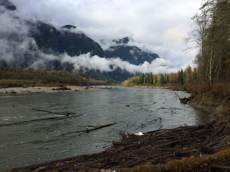
In the past three years, Breen said it has gone off multiple times each year, mostly in the fall when a weather pattern of cold snaps and snowmelts add to the water level. Over the average year, the river will move six metres.
"If you live up there, you're aware that it's definitely a possibility that it's going to flood. You generally know what side of that you want to be on, so having a heads-up is really useful to be able to make that decision," he said. "It's enough if you're in Squamish, you can make it out to the Valley before it really goes sideways on you. Or the other way around — you can get out."
Breen is still adding to the project as he gets more data.
"It turns out there's a snowpack sensor up valley, which also provides temperature and a few other things, which should give us a general idea of flow based on the weather forecast," he said. "There's about a seven or eight degree spread between the elevation of where the snowpack sensor is and the valley. So if we have a forecast that says it's going to be at least 10 degrees, that takes the snowpack level above melt point and we can assume it's going to start to come down."
Concerns about water levels are not new to valley residents, where there is only one access road to the area and they say the shoreline around the Pilchuck Bailey Bridge is eroding.
"What's going to happen is that bridge is going to go in and you're going to have 160 people stuck on the wrong side of it. And not too happy about it, is my guess," he said.
In January, many discussed their worries when a flood hazard map was presented in the valley. It was the first time in 35 years the floodplain in the Squamish Valley had been formally surveyed for geomorphic hazards. At the meeting, residents raised concerns that although the map confirmed hazards they suspected, no mitigation measures were offered.
"No alerting, no heads-up, no plan and no assistance for anyone who wanted to do anything with the data," Breen said.
"If there's government funding out there to get better data, we as a community do have access to some money but not sure that's enough to be able to get at the data we want. I think [this project] shows that if somebody can pony up for the equipment to generate the data, we're able to do something useful with it and turn it into something with a direct impact on people's lives."
Since Breen works on the project on his own time, sign up is by word of mouth. The SLRD Alert is available at www.slrd.bc.ca.


