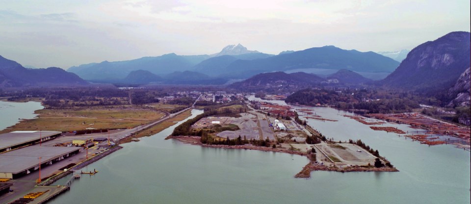
Locals haven't been able to access portions of the Squamish oceanfront to see the changes to the property for a while, but they can now get a bird's eye view of the oceanfront lands through drone footage shared with The Chief.
Squamish's Bennett Land Surveying Ltd. was hired by developer Matthews West to shoot the aerial footage of its Oceanfront Squamish property in late October.
The photographic drone allows land surveyors to quickly take very detailed and accurate measurements of an area, according to Bennett Land Surveying's John Franko, who has lived in Squamish for more than 25 years.
"You can create contours... and surfaces," he said.
Crews did a base survey of the oceanfront property and will be able to follow up and compare as the development continues.
"There's lots of applications for this," Franko said, adding that he was at first hesitant to use drones when they were a new technology, but now is embracing it wholeheartedly.
"It is never going to take away boots on the ground....
“We have to dig in the ground and find those earth posts, that is how boundaries are determined — the evidence that was set by another professional and that is found in the ground."
The team hasn't given the drone a name yet, but are leaning toward C-3P-Drone.
Land surveying is one of the oldest self-governing professions in B.C.
The first land surveying in the province was done in the 1700s. In 1891, the provincial legislature passed the first Land Surveyors Act, according to the Association of British Columbia Land Surveyors.
"There's a long history of advances," Franko said. "They used to just pull a chain for measurement... through faxes, emails — you always have to stay on top of the new technologies."
**Please note, this story has been corrected since it was first posted to say that the drone is photographic. It does not have LIDAR.


