Weather conditions were ripe mid-April for a wildfire to spark in Squamish, according to Matt MacDonald, an Environment Canada warning preparedness meteorologist. All that was needed was a human or lightning ignition.
"A super dry April, very low relative humidities — you've got your dry fuels to burn, you've got really dry atmospheric conditions that will allow the wildfire to propagate and Squamish is a windy place," he said.
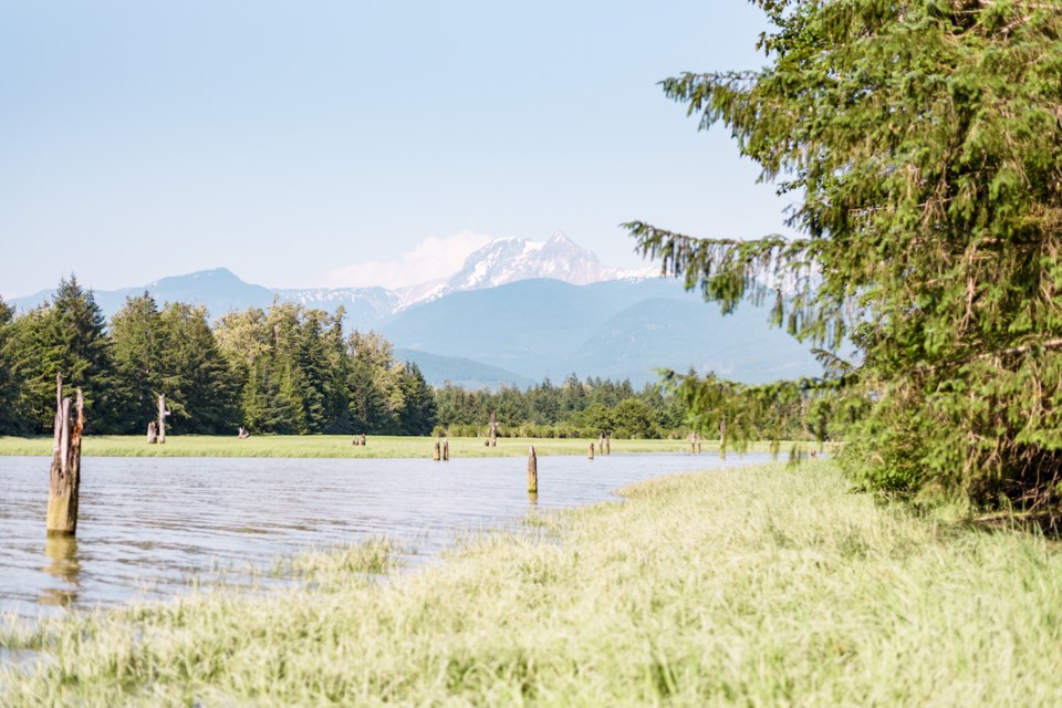
The Magee Road fire started April 15 in the Upper Squamish Valley and is suspected to be human-caused, according to the BC Wildfire Service. It grew to more than 200 hectares and as of April 25 is in the mop-up phase, where crews scan for hot spots and put them out.
April 15, Squamish was extremely dry both in terms of the amount of rain the area had seen to date and the low humidity.
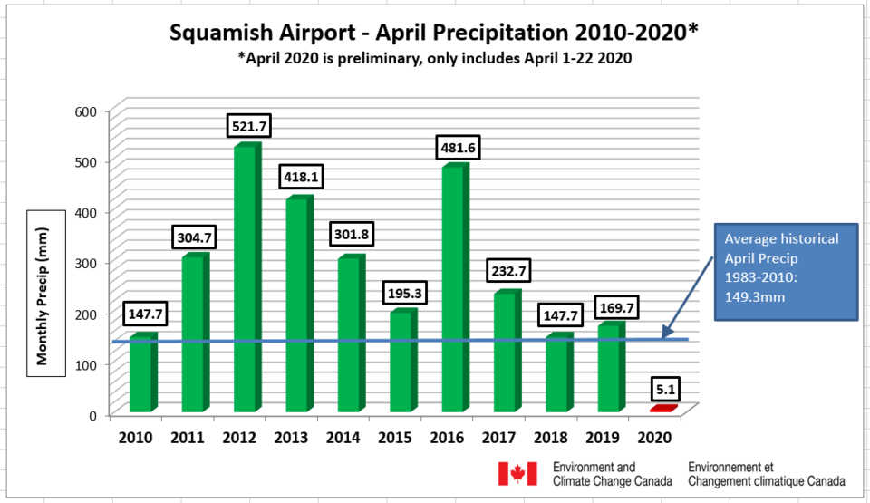
This April, Squamish had seen 5.1 millimetres of rain, as of April 24, and the normal is 149.3mm, MacDonald said.
The current record for the driest April was set in 2004 when Squamish saw 25mm of rain.
Aprils in 2010 and 2018 were the only ones in the last 10 years to see below-normal rainfall and they were just below normal, he said.
April of 2012, saw 521mm; April of 2013 saw 418mm and 2016 saw 481mm of rain.
"We have had some really wet Aprils and then, boom, this year," MacDonald said.
There has been a very resilient and robust weather pattern, that explains the dryness in Squamish, he said.
"We got locked into this really strong ridge of high pressure sitting just off of our shore," MacDonald said, adding that Squamish has been experiencing a northwesterly flow, which is the backside of a ridge of high pressure.
"Our airmass is coming down from northern B.C., Yukon and Alaska, and those air masses tend to be very, very dry."
It wasn't just pandemic-level handwashing causing skin to be dry, MacDonald said, it was also the really low relative humidity.
On the afternoon of the wildfire, the relative humidity was 13%, which is bone dry.
"Those are like Arizona dew points," he said. "You get down to the 10 to 20% relative humidity, it is very, very dry."
Typically, 60 to 80% relative humidity is the norm for coastal climates like Squamish.
With the lack of rain and dry conditions, Squamish is just lucky the winds weren't stronger during the Upper Squamish Valley fire, MacDonald said.
Winds were at 15 to 25 kilometres an hour from the northwest on April 15, at the airport. *
It was likely a bit windier in the valley.
"Had we been dealing with stronger winds, which are quite frequent in Squamish,... that could have been way worse."
Squamish is currently in the midst of a weather pattern change.
Saturday, Squamish is set to see 15 to 20mm of rain.
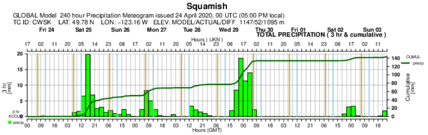
A weaker system on Sunday evening will bring 10 to 20mm. Tuesday and Wednesday will also see rain.
Over the next week, Squamish will see 140mm of rain.
Thus, April 2020 won't go down in the record books as especially dry, although the beginning of the month was drier than any since 1983 when records begin with Environment Canada.
While it is difficult to predict rainfall farther out into the summer, MacDonald said there is some confidence in forecasting that Squamish's summer will be warmer than normal.
"Does that mean it is going to be record-breaking heat with unbearable heatwaves? No... All it means is when we get to September and we look back on June, July, and August, the summer could have been, and perhaps will have been, half a degree, one degree warmer than normal," he said.
The ocean "blob," the massive area of water that is four or five degrees warmer than normal is mixing with the strong cooler storm patterns from the winter.
"And so, for the first time in several years, the ocean off the coast is much closer to normal. That said, it is still just slightly warmer... and that is why our models are hinting at a warmer than normal summer."
*Please note, since this story was first published, MacDonald has revised his assessment of the wind at the airport on April 15 to the numbers shown.


